Role of GPS Navigation in Aviation
Posted by john stoys
Filed in Technology 257 views
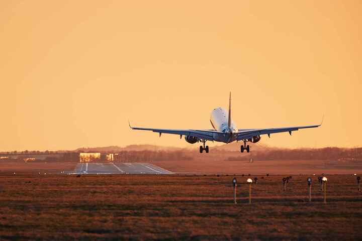
For decades, the sky was navigated by a combination of radio beacons, radar, and celestial observation. Pilots flew from one ground-based station to the next, tracing invisible zig-zag lines across the continents. While effective, this system had limitations in efficiency, flexibility, and coverage, particularly over vast oceans. Today, aviation has been revolutionized by a technology that fits in the palm of your hand but powers the most complex machines on Earth. The Global Positioning System (GPS) has become the backbone of modern flight, fundamentally changing how aircraft are routed, landed, and managed in increasingly crowded skies.
The shift from ground-based navigation to satellite-based navigation represents one of the most significant leaps in aviation history. It has allowed for straighter flight paths, reducing fuel burn and carbon emissions. It has opened up remote airports to all-weather operations that were previously impossible. Most importantly, it has enhanced safety by providing pilots with precise, continuous position data that isn't dependent on the proximity of a radio tower. This transition is not just an upgrade; it is a complete reimagining of the global airspace infrastructure.
To understand the magnitude of this change, we must first address the basics: what is gps navigation in the context of aviation? At its core, it is a satellite-based system that provides aircraft with precise position, velocity, and time information. Unlike traditional systems that measure the angle or distance from a fixed point on the ground, GPS allows an aircraft to determine its exact coordinates in three-dimensional space—latitude, longitude, and altitude—anywhere on the globe. This capability is independent of terrain or weather, providing a reliable thread of data that connects the cockpit to the digital world.
This article will explore the multifaceted role of GPS in modern aviation. We will examine how it streamlines flight planning, enhances safety through improved situational awareness, and enables the precision approaches that allow planes to land in near-zero visibility. From the busy terminal airspace of major hubs to the remote airstrips of the Arctic, GPS is the invisible force guiding the future of flight.
The Mechanics of Satellite Navigation in Flight
The aviation industry relies on a level of precision that far exceeds what is required for driving a car or finding a restaurant. An error of a few meters might be negligible on a highway, but on a runway approach in fog, it is critical. To achieve this, aviation uses not just the standard GPS signals, but also augmentation systems that refine the data to sub-meter accuracy.
The Constellation Overhead
The system begins with the space segment—a constellation of satellites orbiting the Earth. These satellites act as precise reference points. An aircraft's receiver picks up signals from multiple satellites simultaneously. By measuring the time it takes for these signals to travel from space to the receiver, the onboard computer calculates the distance to each satellite. Through trilateration, the system determines the aircraft's exact position.
Augmentation for Precision
Standard GPS is accurate, but aviation requires "integrity"—a guarantee that the data is correct. To ensure this, systems like the Wide Area Augmentation System (WAAS) in North America or EGNOS in Europe are used. These systems rely on a network of ground stations to monitor satellite signals for tiny errors caused by atmospheric disturbances or clock drift.
These ground stations can also integrate data from meteorological sensors to account for ionospheric delays that affect signal speed. The corrected data is then sent to a geostationary satellite, which broadcasts the refined signal back to the aircraft. This process ensures that the position data is accurate enough for critical maneuvers like landing.
The Role of the Satellite
In this complex dance of data, what do satellites do? They serve as the primary beacons, continuously broadcasting their location and time. They are the immutable stars by which modern aircraft steer, providing a global reference frame that remains constant regardless of national borders or physical geography. Without their relentless transmission of timing signals, the high-precision 4D trajectory management (latitude, longitude, altitude, and time) required for modern air traffic control would be impossible.
Transforming Flight Planning and Efficiency
Before GPS, flight paths were largely dictated by the location of ground-based navigational aids (NAVAIDs) like VORs (VHF Omnidirectional Range). Aircraft had to fly from VOR to VOR, often resulting in indirect routes that added miles and minutes to every journey. GPS has untethered aviation from this ground-based infrastructure.
Area Navigation (RNAV)
GPS enables Area Navigation (RNAV), which allows aircraft to fly any desired flight path within the coverage of station-referenced navigation aids or within the limits of the capability of self-contained aids, or a combination of these. In simple terms, planes can now fly direct routes between two points. This "point-to-point" navigation significantly reduces flight distances, saving millions of gallons of fuel annually and reducing the industry's environmental footprint.
Required Navigation Performance (RNP)
Building on RNAV is Required Navigation Performance (RNP). RNP allows an aircraft to fly a specific path between two 3D-defined points in space. RNP is like a virtual tunnel in the sky. If the aircraft deviates from this tunnel, onboard monitoring systems alert the pilot. This precision allows planes to fly curved approaches into airports nestled in difficult terrain—like valleys or city centers—avoiding obstacles and noise-sensitive areas that would be impossible to navigate with straight-line ground-based signals.
enhancing Safety and Situational Awareness
Safety is the paramount concern in aviation, and GPS has provided tools that drastically reduce the risk of accidents, particularly those categorized as Controlled Flight Into Terrain (CFIT).
Terrain Awareness and Warning Systems (TAWS)
Modern aircraft are equipped with TAWS, often referred to as EGPWS (Enhanced Ground Proximity Warning System). This system uses GPS position data overlaid on a detailed digital terrain map stored in the aircraft’s computer. It "looks ahead" of the aircraft and warns pilots if their flight path is projected to impact the ground or an obstacle. Because the system knows exactly where the plane is and exactly where the mountain is, it can provide timely, life-saving alerts even in zero visibility.
Automatic Dependent Surveillance-Broadcast (ADS-B)
GPS is the engine behind ADS-B, the next-generation technology for air traffic surveillance. With ADS-B, an aircraft determines its position via GPS and periodically broadcasts it to ground stations and other aircraft.
- ADS-B Out: Transmits the aircraft's position, altitude, and velocity to air traffic control, providing a more accurate and frequent update than traditional radar.
- ADS-B In: Allows pilots to see other traffic on their cockpit displays, just like air traffic controllers do. This shared situational awareness significantly reduces the risk of mid-air collisions and allows for tighter spacing of aircraft, increasing airspace capacity.
The Revolution in Approach and Landing
Perhaps the most critical phase of flight is the approach and landing. Historically, precision landings in poor weather required expensive Instrument Landing Systems (ILS) installed at the airport. An ILS shoots radio beams up from the runway to guide the plane down. However, these systems are costly to maintain and are typically only found at major airports.
Localizer Performance with Vertical Guidance (LPV)
GPS has democratized precision approaches. With WAAS-enabled GPS, aircraft can fly LPV approaches. These approaches provide vertical and horizontal guidance similar to an ILS but without the need for any equipment at the airport other than the runway itself. This capability has opened up thousands of smaller, regional, and general aviation airports to safe operations in bad weather, providing a lifeline for remote communities and business aviation.
Required Navigation Performance - Authorization Required (RNP AR)
For challenging airports surrounded by mountains (like Queenstown, New Zealand, or Juneau, Alaska), RNP AR approaches allow aircraft to fly precise, curved paths down to the runway. Instead of a long, straight-in approach that might be blocked by terrain, planes can weave through valleys, guided by GPS accuracy to within a wingspan's width. This capability reduces the number of diverted flights and makes air travel more reliable in difficult environments.
Modernizing Air Traffic Management (ATM)
As global air traffic continues to grow, the old methods of managing airspace—based on radar and voice communication—are reaching their limits. GPS is the cornerstone of modernization efforts like the FAA's NextGen in the United States and SESAR in Europe.
Trajectory-Based Operations (TBO)
The future of air traffic control is Trajectory-Based Operations. Instead of controllers giving pilots vector commands (e.g., "turn left heading 270, descend to 20,000 feet"), TBO uses the aircraft's advanced flight management system and GPS to negotiate a precise 4D path (latitude, longitude, altitude, time) from takeoff to landing. The aircraft flies this path automatically, arriving at a specific merge point in the sky at an exact second. This strategic management flows traffic more smoothly, reduces holding patterns, and optimizes runway usage.
Optimized Profile Descents (OPD)
Traditionally, aircraft descend in steps—dropping altitude, leveling off, powering up, and dropping again. This "step-down" approach is noisy and burns excess fuel. GPS allows for Optimized Profile Descents, where the aircraft glides down from cruising altitude to the runway threshold in a continuous, low-power descent. It’s like coasting a bicycle down a long hill rather than pedaling down stairs. OPDs significantly reduce fuel consumption and noise pollution around airports.
Challenges and Resilience
Despite its immense benefits, reliance on GPS introduces new vulnerabilities. The signal from satellites is weak by the time it reaches Earth, making it susceptible to interference.
Jamming and Spoofing
GPS jamming (blocking the signal with noise) and spoofing (broadcasting fake signals to mislead the receiver) are growing concerns. Military conflicts and malicious actors can disrupt civilian aviation navigation over large areas. To mitigate this, aviation authorities are maintaining a "Minimum Operational Network" of traditional ground-based NAV